Red Pine Lake, Utah
I think it was John Steinbeck who first coined the phrase, “the best made plans of mice and men”, which for me gained new relevance on a recent trip to Utah. I came to quickly understand this utterance all too well when the goals I’d set for a hiking trip were decimated by the arrival of a cold front, the day after I arrived.
My plans were to spend most of my vacation in the high country of the Wasatch Mountains, just east of Salt Lake City. When the wheels of my flight touched down around lunchtime, it was a balmy and breezy 88 degrees F. That changed within a few hours as a massive wave of arctic air blasted into the area, dropping the temperature by 50 degrees overnight. When I walked outside and looked across the valley at my planned hikes I found they were covered in snow, down to about 6,000 feet, which was way below my destinations.
Even so, I was there and as such decided to “go for it”, even though I didn’t really have the right gear for snow hiking (Kentuckians don’t have much of a need for such things). My buddy Jeff and I headed out for one of the premier hiking areas in the area, Red Pine Lake in Little Cottonwood Canyon. It was a very strange experience too, hiking in a forest with peak fall colors, all covered in heavy snow.

Red Pine is located in the heart of the Lone Pine Wilderness Area within the Wasatch-Cache National Forest. It’s one of two very nice lakes in the area, the other being White Pine Lake. The trailhead (White Pine) lies at 7,580 feet above sea level, and with a gain of 2,040 feet, this hike pushes you very close to the always-fun elevation of 10,000 feet at 9,620 feet above sea level. As a side note, this area was once mined, but proved to be uneconomical and as such the operation ended, leaving behind only the memory.
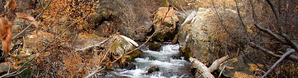
The trail itself is a 7-mile round trip to and from the lake. Along the way you’ll have stream crossings, great views through the trees, incredible alpine scenery and find lots of other people enjoying the same trail, even in the snow. At the lower elevation we had only small amounts of the white stuff to navigate through, but by the time we got to the lake it was over a foot deep in some areas, not a good thing for someone wearing jeans and not-too-waterproof boots. My Smart Wool® socks basically kept me moving as they maintained some insulation value even when wet and boy were they wet!
In addition to the elevation, snow and other hikers, there was a biting wind to make the experience even more memorable.

Getting to the lake under these conditions made me feel like I’d accomplished something. Snowfall had completely covered the water and everything around it. You could see the crest that separates Little Cottonwood and American Fork Canyons. The Pfeifferhorn Peak (11,326 feet above sea level) dominates the scene to the southwest, and to the north you’ll see Dromedary Peak (11,107 feet above sea level).
The lake itself is about 600 feet long with a small bay tucked into the south end, where the forest meets the shoreline. As the wind chill was pushing the temperature to very low levels our stay there wasn’t very long, but still worthwhile. If you decide to take this hike, go before the snow arrives, or equip yourself with the right gear. Either one would have made this hike more comfortable.
